Outdoor Adventures in the new “normal”

2020 has seen a major change to all our lives with the Covid-19 pandemic. As we continue to make our way through the year things will change. Already the lock down is being eased and we are all starting to venture out a little more. But the big question is “what will it all mean for us in terms of getting out and having some adventures again?”

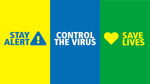
The Government has changed it’s message to ask us to stay alert, control the virus and save lives. But can we do this whilst having outdoor adventures?

Coronavirus: Leaders unite against PM's 'stay alert' slogan | UK ...

The answer is not straight forward really. There are lots of things to consider and I feel there is no right or wrong answer. It is up to us all to decide if we want to head out and have fun and ask ourselves some important questions. Here are some of the things we will all need to consider when planning our next adventure.

Plan Ahead

Firstly, you will need to make sure that what you plan on doing is allowed in the country you wish to go to. With England, Scotland, Wales and N Ireland all having different rules around the number of people going out and distance you can travel, it is important to check you are following the correct rules.

Once you have decided what you are going to do and where you are going to go, you will want to think about keeping yourself and others safe. If you decide to travel to popular locations then being able to social distance in car parks, picnic areas will be difficult. Many areas may have limited parking options and may not have opened other facilities such as toilets, so think carefully about your impact on the area and the local communities. If you can head to quieter places where parking may not be an issue try and go there.

Social Distancing

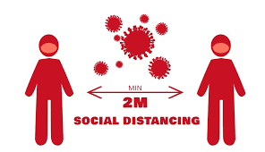
If you are from the same household the need to socially distance is reduced, needing you only to avoid other people. If you are a group of friends from different households then you will also need to socially distance from each other. Some outdoor adventures will be difficult to socially distance from one another for safety reasons and the nature of the activity. Avoiding people where you are forced to use certain routes, where it is impossible to keep a 2 metre distance, should be something to think about. Scrambling along a narrow ridge may not be the ideal place to social distance. Here are some thoughts on different outdoor activities:
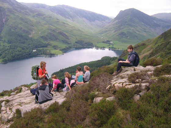
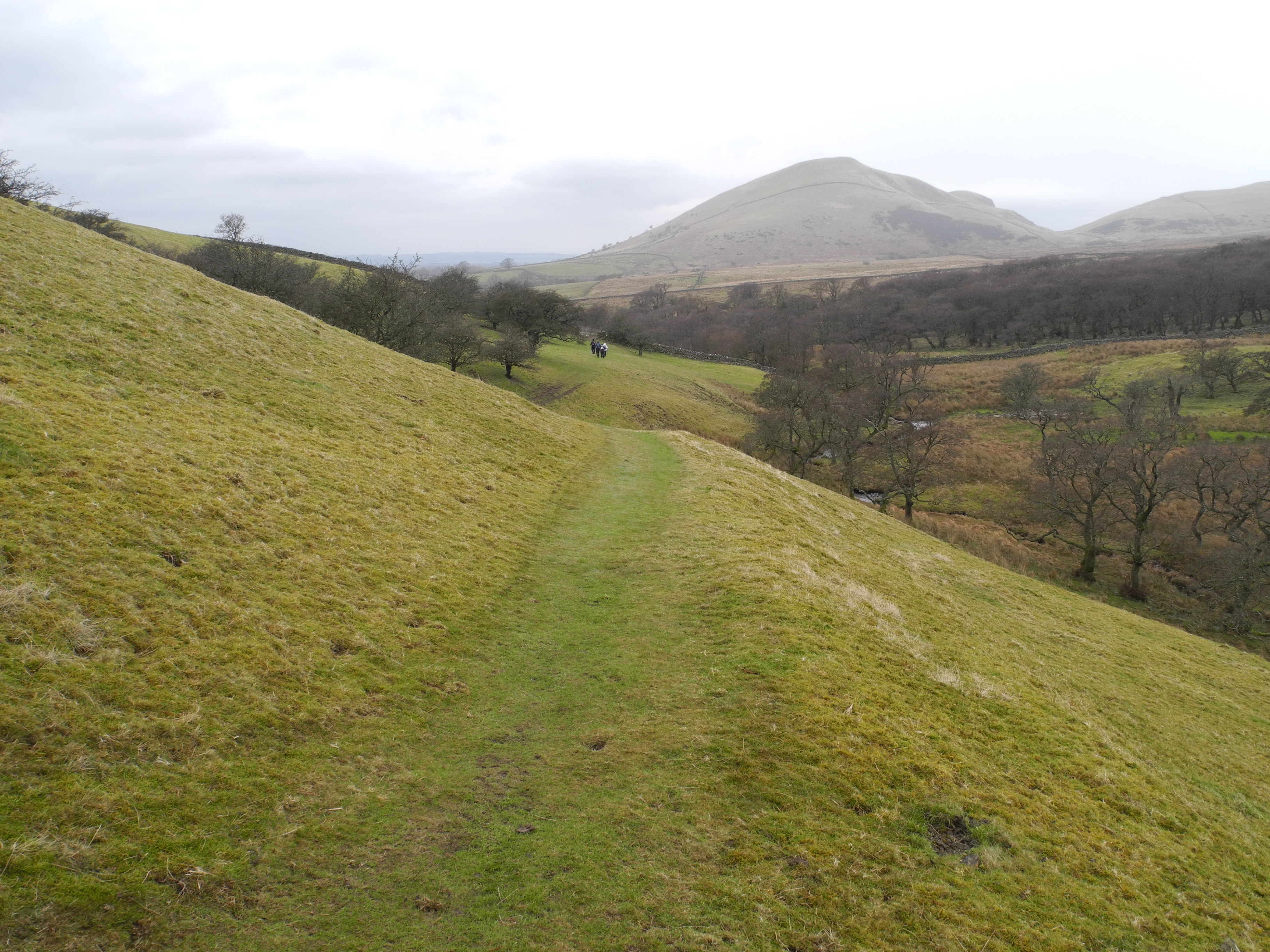
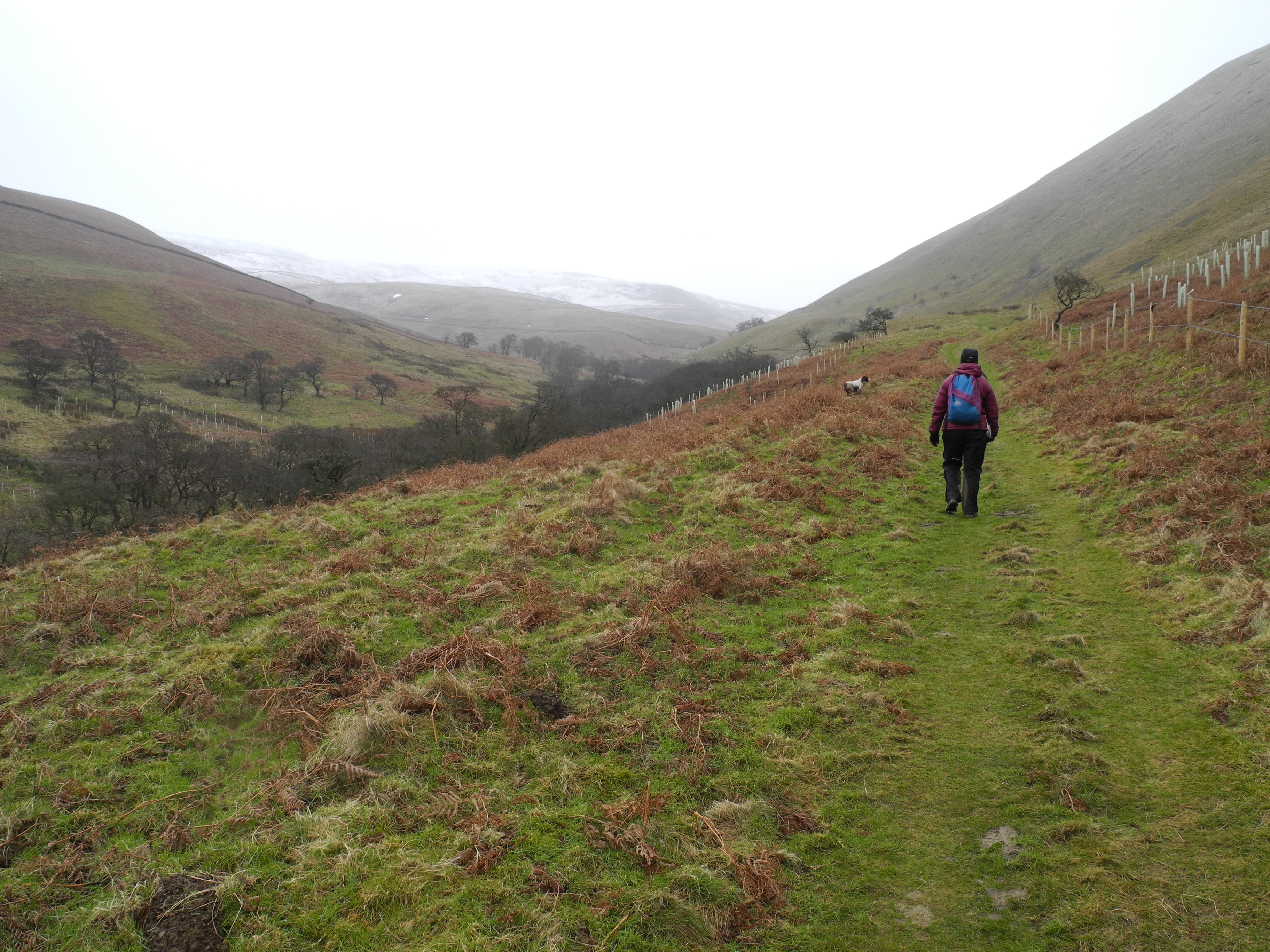
Coronavirus: Two Metre Rule Will Protect Workers - The Wave

Walking

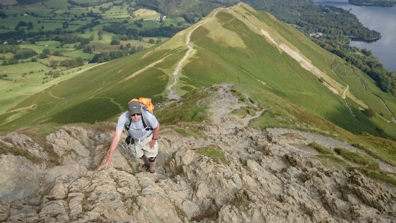
It is possible to enjoy days out in the beautiful valleys and on the fells and social distance. Think ahead and try and avoid popular areas to make this easier. Avoid routes where you know it is impossible to allow people to pass without breaking the social distancing rule. If you are out with friends from different households remember to social distance. Remember this is a new “normal” and not how you used to walk together. If you see other people on your route plan ahead: Where would be best to pass? Look for places you can step off the path to give others room. Think about where you are going to stop for rests and lunch. That summit shelter may not be the best place to social distance. Using a local guide will help you find the perfect route away from the “honeypots” and will take away the need to navigate and plan the day.

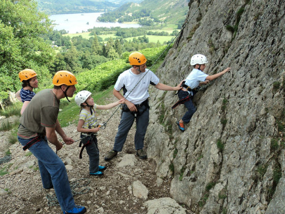
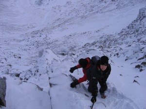
Scrambling / rock climbing

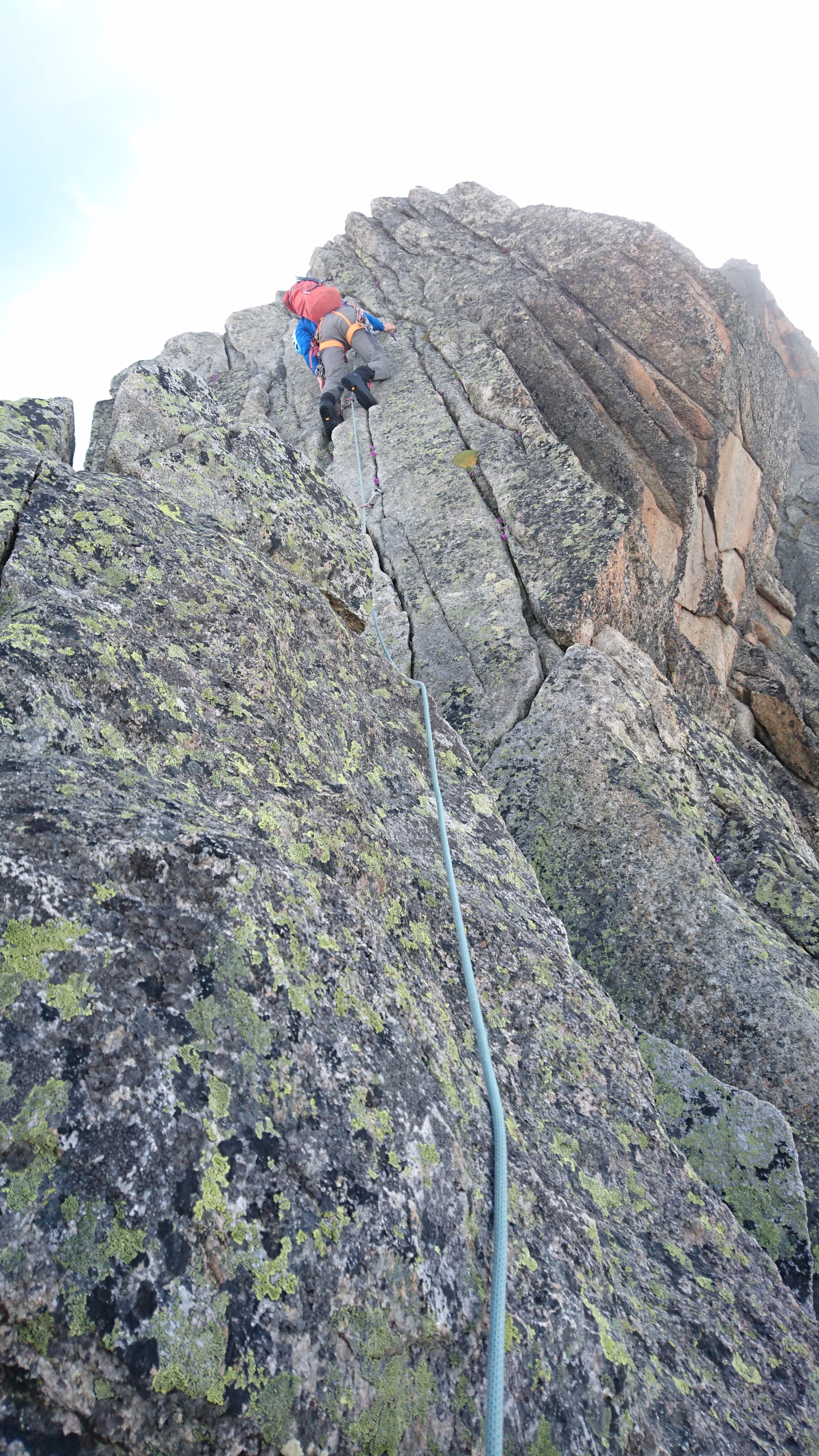
These two activities often require you to follow a set route/line. Popular climbs and scrambles may be busy, making it more difficult to ensure that you social distance. You will need to avoid catching parties up ahead and hope that the party behind do not catch you up. At the end of each rope length (pitch) you will need to belay your partner up on climbs and more technical scrambles. Will you be able to social distance at this point? Not a problem for people from the same household, but for others it is. These areas can often be a bottle neck with parties catching up with each other so care needs to be taken. Many climbs can be found next to one another so check the routes either side of you to see if you might end up close to other climbers on other routes. If you are looking to learn to scramble then a local guide should be able to take you on the easier scrambles around the Lake District. These should not involve the need for a rope. If you want to learn, or just have a go at climbing, this will be difficult as trying to social distance with a guide and learn the skills needed may be impossible.
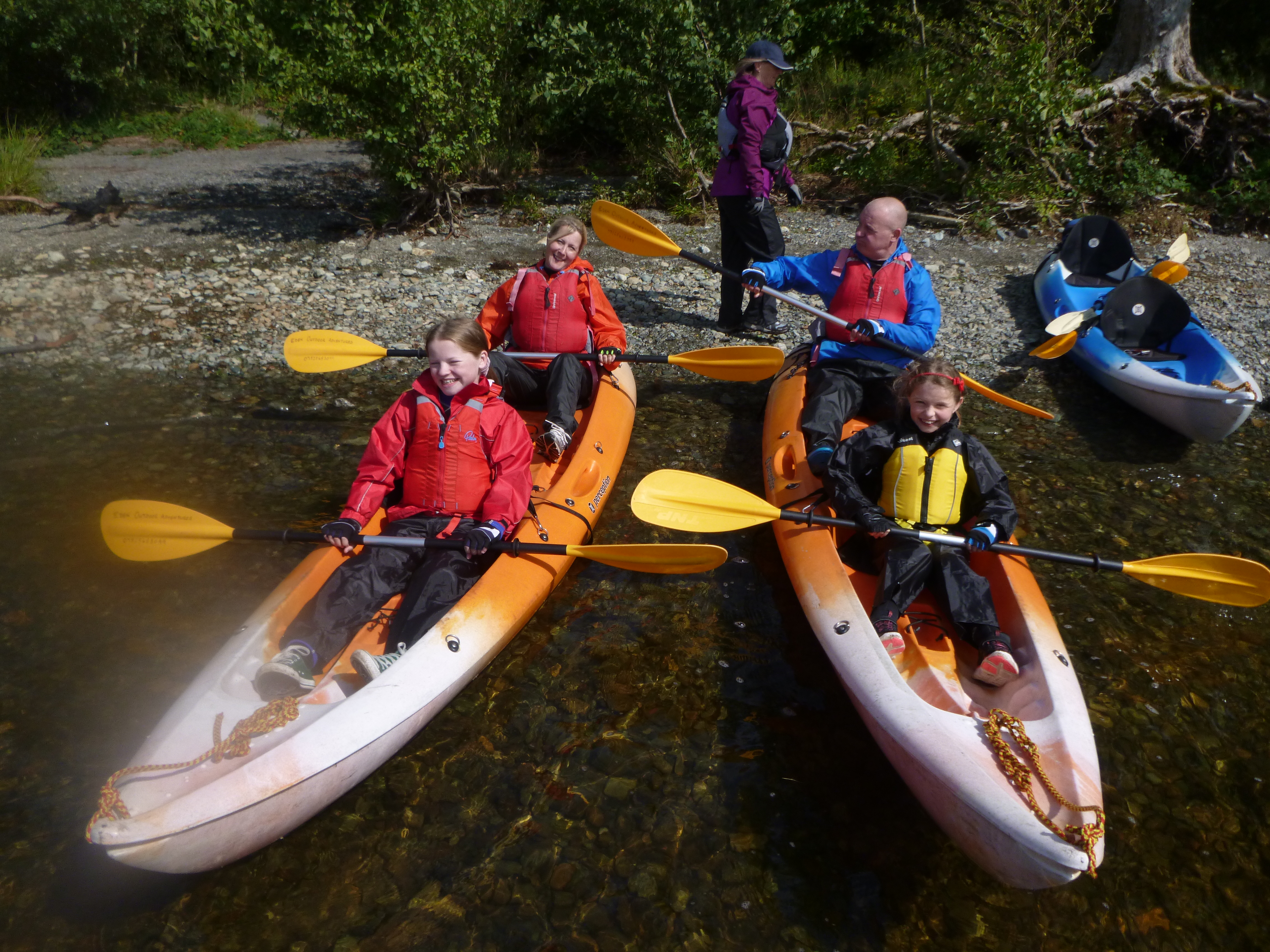
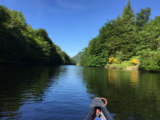
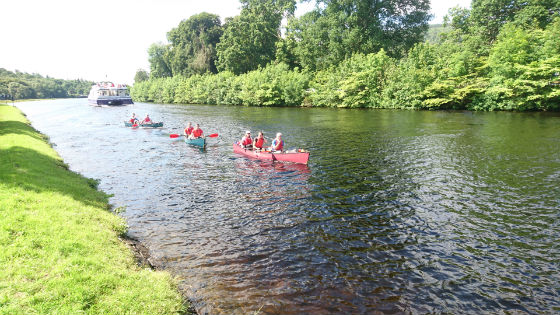
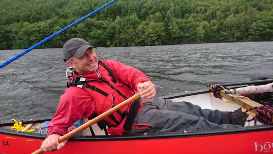
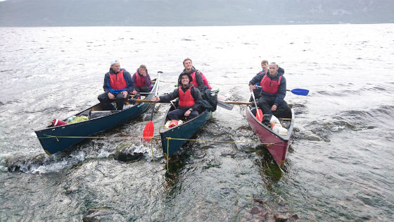
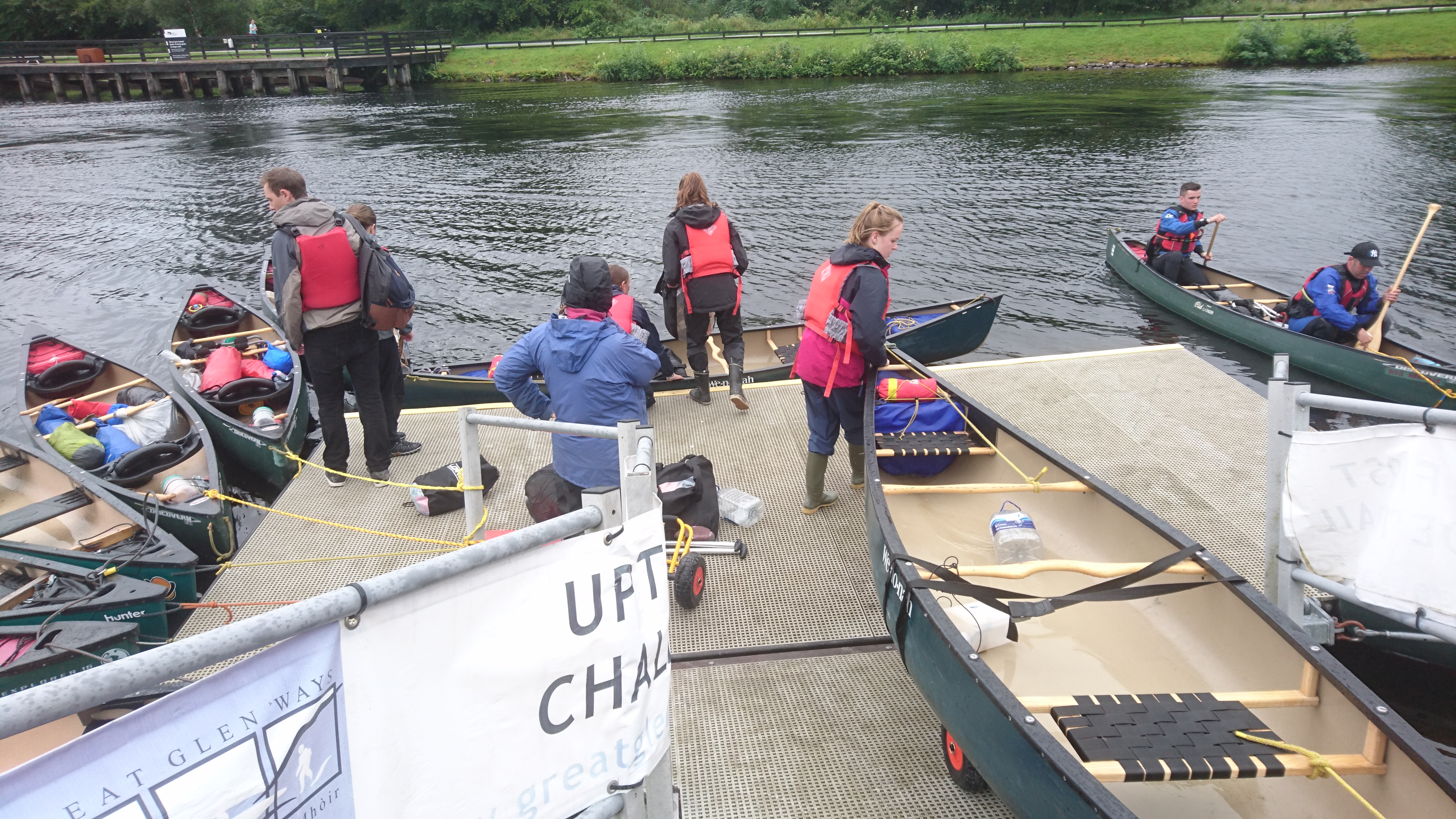
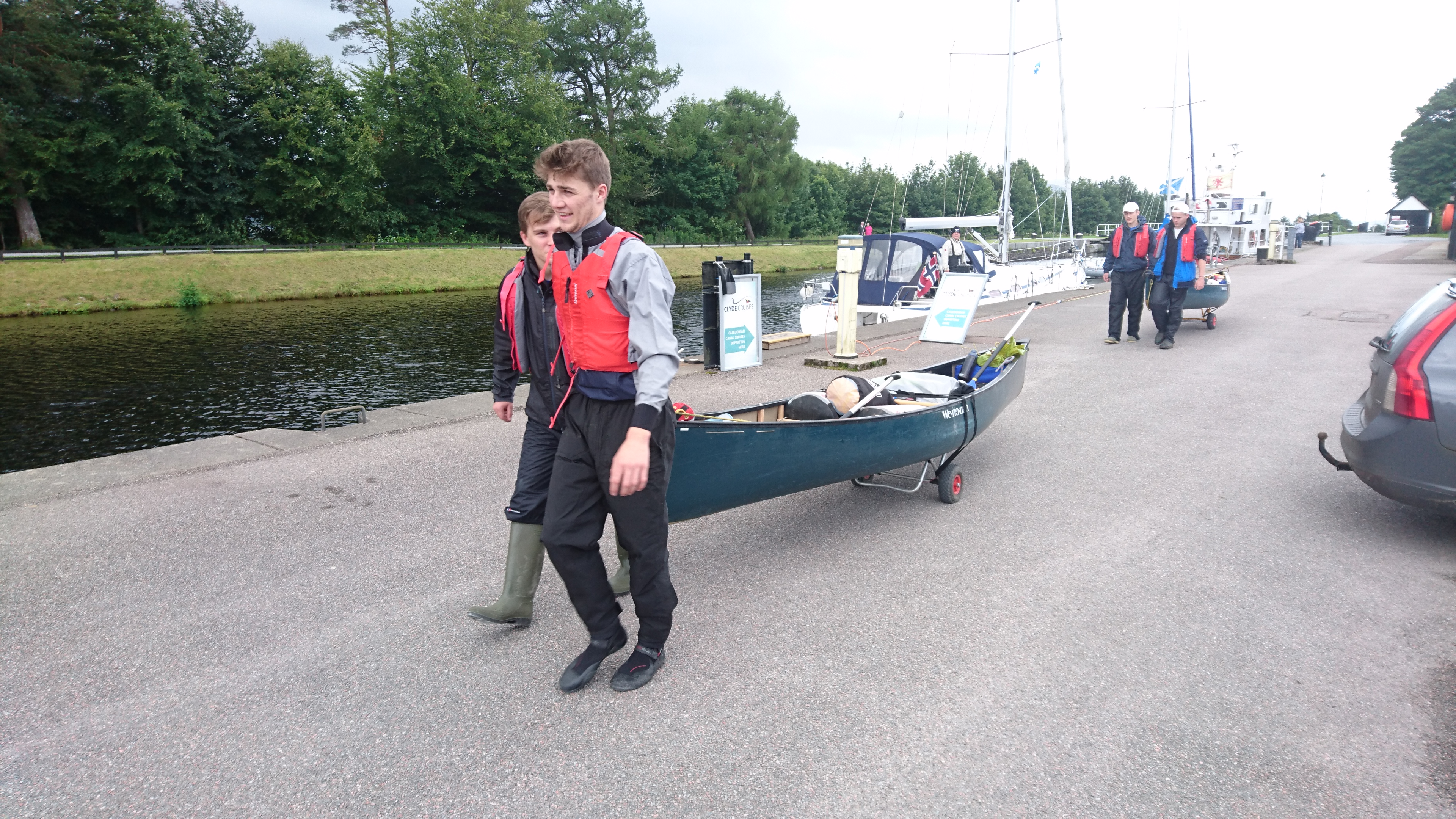
Canoeing / kayaking

This activity will mainly allow people to social distance from one another, no matter whether you are from the same household or not. Most canoes will have seats 2 metres apart. Double sit on top kayaks are a little closer at just over 1 metre. You will still need to avoid breaking the social distancing rules by not coming together in a raft if you are from different households. If you are from different households you will also need to be able to cover your face if you need to break the social distancing rules to help rescue someone who capsizes. With an instructor this is a great activity to give a try if you are looking to have an adventure and explore the Lake District from a different angle.

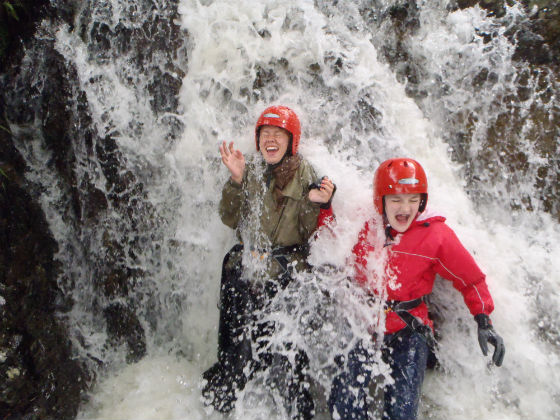
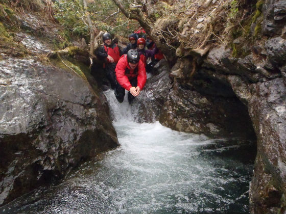
Ghyll Scrambling / Canyoning

This activity has become popular in the Lake District. It is often undertaken through an outdoor provider with local knowledge of the ghyll or canyon and they provide any special equipment needed. As these activities require people to follow a mountain stream either up or down then often the route is set. This means that the group will need to ensure they remain socially distanced from their instructor and other people in the ghyll or canyon and, if you are from different households, from each other in the group. This could result in long lines of people in the ghyll or canyon, or waiting to get in to start the activity. This was already happening pre Covid-19 in some ghylls such as Stoneycroft Ghyll near Keswick. As this activity is often led by an instructor they will need to work out how they can socially distance, give clear information on how to get up or down the ghyll/canyon and ensure that people are safe and protected at all times. This will be easier for groups from the same household as they can help one another and stand together in a group, but it will be more difficult than previously. So if you plan to give this activity a try and use an activity provider, ask how they plan to run the trip based on the new “normal”?

Reducing the spread

Reducing the potential spread of Covid-19 is going to be important. Being in the outdoors often means access to soap and water is limited. So having a good supply of hand sanitiser is going to be important. As you come into contact with items that may have been used by many people think about using the gel. Car parking machines, public toilets and gates are amongst the many places people will have touched. Each time you stop to eat or drink clean your hands before and after. Think about the kit you are using. If you are out with people from different households you should ensure it is clean before others use it and cleaned afterwards before others use it. This is particularly important for shared equipment such as climbing ropes and safety equipment. If you are using an outdoor activity company ask to see what measures they have in place regarding reducing the spread of Covid-19.

Putting others at risk

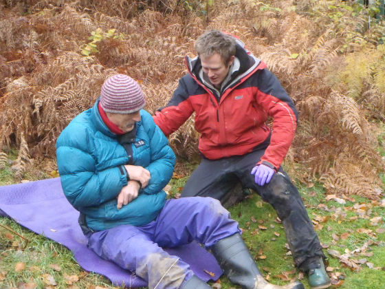
The lakes and fells are open but should we go? Many rescue teams at present are keen to see as few call outs as possible. But, if you do decide to head out onto the water, into the hills or onto rock, then follow some sound advice. If you have not been out for some time then start off easy and choose something well within your capabilities. Ensure that you do not take risks that can be avoided. Take all the correct kit for the activity and the weather conditions. Know how to look after yourself, by being able to navigate and carry out first aid etc. Plan to be self sufficient. If you call for a rescue you will find that the rescue team will be smaller, often they will be on foot rather than in a helicopter and the rescue will be longer than it would have been pre Covid-19. By being sensible and prepared you will hopefully not need to put the rescue teams at risk. If you do not have the right equipment or skills then do not head out on your own; hire a guide/instructor who can help ensure your safety.

Although studies suggest being outdoors provides a low risk for catching Covid-19, we can all do our part to reduce the risk of catching it or passing it on. If we feel unwell and have any signs or symptoms of Covid-19 or been in contact with someone who has in the last 14 days, then we should not plan on heading out for an adventure. Plan ahead and think about what you want to do and where you are going to go. Take measures to reduce the chances of catching the virus by social distancing and cleaning your hands regularly and also kit, before and after you use it. Make sure you have the right equipment and skills to have the adventure you want, rather than it turning into a different kind of adventure!

Whatever you decide to do, we hope you have a safe, fun and Covid-19 safe adventure on your next trip to the Lake District!

Posted in Canoeing, Climbing, Covid19, Family Activities, Ghyll Scrambling, Walking | Leave a comment

Family Adventures

Working out what to do with your family is never easy. What will suit everyone? How old do the children need to be? What if the weather is not good on the day?

These are some of the questions we get asked. So here are our thoughts and hopefully some answers to help you plan your family’s next outdoor adventure.

There is no simple answer as to whether one activity will suit the whole family. But whatever you choose Eden Outdoor Adventures will make every effort to include the whole family at a level that suits them. It is always possible to cater for a range of ages, abilities and aspirations in all the activities we offer and we will encourage everyone to be as involved as they feel comfortable with.

With this flexibility it also means we cater for a range of ages with our youngest customer so far being 2 years old and our oldest being …. ??? Age is just a number!

If your family wants to stay dry then we can offer rock climbing or hill walking. Both are great family activities. We offer climbing in the Ullswater and Borrowdale valleys. There are a number of fantastic climbing crags to choose from allowing us to select the best one for the age of the group and their previous experience. We can offer climbing to challenge all abilities and teach everyone to climb and belay (hold the rope for the climber) during the activity.

child climbing
family climb 1

There are wonderful low level and high level walks for the whole family in the Lake District, North Pennines, Eden Valley and the Northern Yorkshire Dales. We can take you along lake shores, through woods and meadows or up onto the lower fells that give enchanting views over the valleys below.

Walking Buttermere Lake District
family walk

If messing about on the water is your thing then try canoeing or sit on top kayaking. We have two of the most beautiful lakes to paddle on (Ullswater & Derwentwater) along with some easy rivers. Canoeing is a great way to travel on the water with less chance of getting too wet. For those who are nervous we can take boats and join them together using wooden spars and straps to turn them into a catamaran  which is very stable and pretty much impossible to capsize. Like this we can cater for families with small children and can provide life jackets for the smallest of family members.

P1100643
family canoe 8

For those who do not mind getting a little wetter, then exploring on a double sit-on-top kayak would be a great option. These are pretty stable and even if you do capsize all that happens is you fall off and then climb back on again. Wetsuit provided!!

Family kayak 1
P1130114

Once we have taught you the basic skills we head off on a journey. This will see you exploring bays and islands around the lake. Along the way we stop for a drink and snack. We can combine our canoe trips with a BBQ or can light a fire and cook marshmallows. We can mix and match boats if families want to try both canoeing and sit on top kayaking, just let us know what you would like to do and we will do the rest.

OLYMPUS DIGITAL CAMERA
canoe camp fire

If you are looking for something a little different and love to get wet then why not try ghyll scrambling? This is where you explore one of the Lake District’s mountain streams. In the Ullswater and Borrowdale valleys you can start at the bottom and scramble your way up over rocks and short waterfalls as you climb higher to admire the views. Or in the Newlands valley near Keswick you can walk up on a good path to the top of the ghyll. From there you come down taking advantage of natural water slides, along with jumps and dives to keep even the most adventurous entertained!

Angle Tarn 3
group 1

So having a family adventure couldn’t be any simpler. rock climbing, ghyll scrambling and canoe or kayaking are all half days (morning or afternoon).  Walking can be low or high level and can be half or whole day.  You can also choose two activities and have one in the morning and one in the afternoon. All you have to do is decide what activity you would like to do, then let us know when! We need some information about your family and where you are staying and Eden Outdoor Adventures will then work out the best location for your adventure and sort the rest. We provide all safety kit needed including wetsuits and waterproofs for activities where you will get wet. So take the stress out of having an adventure and give us a call to organise it for you.

OLYMPUS DIGITAL CAMERA
Posted in Canoeing, Climbing, Family Activities, Ghyll Scrambling, Uncategorized | Tagged , , , , , , , , , , , , | Leave a comment

Great Glen Canoe Journey

Looking for a multi day canoe journey? The Great Glen Canoe Trail has something to offer everyone. It can be used by families, friends or groups doing their Gold Duke of Edinburgh Award.

The full trail goes from Fort William to Inverness following the famous Caledonian canal and through three major Lochs. However, it is possible to start and finish in a number of places, meaning it can be paddled as a continuous journey or broken down into 2 smaller trips depending on the time available and the age and ability of the group.

As the route comes close to the A82 in a number of places it is also possible to take advantage of a number of accommodation options from very basic wild camping with no facilities, through to hotel accommodation each night with options in between.

GG 4

DSC_0350

The paddling is not technical, so it is suitable for people with little or no previous canoe experience. There is plenty of time to learn the basic skills to allow you to complete the trip. Paddling along the Caledonian Canal is relatively sheltered providing a good place to learn the paddle stokes you will need on the larger open sections of the lochs. The canal sections are often tree lined and can be beautiful in the Autumn.

GG3

GG2


There are three lochs to paddle, Loch Lochy, Loch Oich and the most famous of them all, Loch Ness.

D of E GG 2

Great Glen 1

These sections can provide flat easy paddling, but with just a small amount of wind this can turn into paddling in large waves. This can be fun if you raft the canoes together, making them very stable. If the wind is going in the right direction you can even use a purpose made canoe sailing rig to allow the wind to help with the journey.

D of E GG 3

DSC_0240

As you paddle along the Great Glen there are beaches to stop at and stretch your legs. On the canal sections you will find toilet and shower facilities. These can be really useful if you are choosing to wild camp.

DSC_0182

DSC_0355

The trip can be done in either direction taking advantage of the wind and weather conditions. Overall the trip is not difficult, but it does require a reasonable level of fitness to allow you to paddle each day. You also need to portage your canoe on a trolley round the canal locks which you are not allowed to paddle through.

DSC_0311

DSC_0166

So if you are wanting a fantastic multi day canoe journey through spectacular scenery then why not do the Great Glen Canoe Trail? This 60 mile trip can be done over four to five days. The best time to do it is from the end of April to end of May or mid September to the end of October. So why not give us a call and organise your Great Glen Trip?

DSC_0380

Posted in Adventure Journeys, Canoeing, Uncategorized | Tagged | Leave a comment

Snow Shoeing in Les Carroz

The village of Les Carroz is situated above the l’Arve Valley in the Haute Savoie in France. In the winter it is a part of the large ski area known as the  Grand Massif which includes Flaine, Morillon, Samoens & Sixt.

les carroz village

Les Carroz Village

The village sits below the ski slopes on a flat area high above the main Arve Valley. It offers a range of accommodation to the visitor and outside of the peak ski weeks it is a quiet and pleasant place to base yourself.

DSCN1397

Snow Shoeing through alpine meadows

DSCN1180

Meadows and woodland make Les Carroz a great place to snowshoe

Like many ski resorts they have decided to cater for the non skier or those looking for a day off. They have designed six snow shoeing routes around the resort of various lengths and difficulties. The area also has a number of other possible routes, some waymarked and others not.

DSCN1243

Route waymarking

DSCN1212

Great views

You can spend time wandering through the woods and meadows to the north of the village on two waymarked tracks. Both involve short sections of ascent and descent through the woods. One of the trails heads out to a large boulder at Pierre a Laya . Legend says it was a stone that a giant shook out of his boot one day whilst out walking. From here the views of the mountains on both sides of the valley are fantastic.

DSCN1127

Pierre a Laya

DSCN1420

Alpine picnic

There are three trails that can be combined in various ways to give a variety of days out. One trail heads up to a cross called Croix des 7 freres. History says that a farmer had seven sons. When he died, the brothers felt the farm could not be split between them. As a result they fought to the death, the winner walked to the top of the hill, where he was then struck by lightning! The cross marks the spot where he stood. These routes also allow you to visit Les Tronchets where you can sample some excellent local dishes or drinks.

DSCN1166

Croix des 7 freres

DSCN1290

Stop for food and drink at Les Tronchets

Between some of the pistes and the gondola there is a fantastic trail that picks its way up the hillside through the forest using forest tracks and  narrow paths through the trees. If you are lucky and have fresh powder snow then the walk can be magical!

DSCN1317

Breaking trail in fresh powder snow

DSCN1332

Narrow paths through forests

Take the free ski bus to the cross country ski area of Agy. From there you can either spend the day snow shoeing on one of the pre made trails or better still follow a series of trails up on a ridge to walk back to Les Carroz.

DSCN1391

snow shoeing is a great thing to do with friends

DSCN1362

Explore a magical wonderland

So if you are looking for an alternative winter holiday then why not give snow shoeing a try? Why not hire a guide for the week?

DSCN1247

Why not hire a guide?

DSCN1193

Enjoy some great days out!

Posted in Places of Interest, Snow-shoeing | Tagged , , , , , | Leave a comment

A walk from Dufton in the Eden Valley

This walk starts from the pretty village of Dufton situated at the foot of the North Pennines in the beautiful Eden Valley. The name of the village is derived from the Anglo Saxon for a farmstead where doves are reared.

DSCN1515

Dufton village green

The village is set out around a green with long houses and barns forming the main buildings. There is a large hall at one end of the village. In the centre of the village is the pub the Stag Inn. This reflects the fact that this area was part of the Royal Hunting Forest of Inglewood. The Norman King William Rufus appointed wardens to guard the forest.

In 1670 the forest was leased to Sir Christopher Clapham, the owner of Dufton. He managed to find a loop hole in the lease which allowed him to fell the whole of the forest and sell the timber.

The Stag Inn

The Stag Inn

The village grew in the 18th Century when Dufton mine was opened by the London Lead Company. This Quaker owned company extended the village as well as introducing a water supply to the village. This can still be seen in the form of a well and a deeper channel to allow people to draw buckets of water from.

DSCN1518

Water channel in Dufton

The Latin inscription reads: “here is a clear fountain, shining with silver water. Shepherds do not defile it, nor she goets grazing on the mountain, nor other herd or flock. No flying thing nor wild animal molests it, nor branch fallen from tree”

DSCN1516

Water fountain Dufton

There is a small car park with public toilets in the village as well as space around the green if you need it. From the car park turn right and then right again down the footpath signposted to Dufton Ghyll. The field which is used for camping is known as the Grandee, which in the spring is carpeted in snowdrops.

The track drops down to the ghyll and crosses it by a stone bridge before rising up the other side. This wood belonged to the Manor of Appleby until 1962. The new owner then removed more of the mature trees for timber much to local objection. In 1980 the woods were purchased by the Woodland Trust. The trust have been working to re-establish the woods and develop them for future generations.

Dufton Ghyll Woods

Dufton Ghyll Woods in spring

At the junction take the right hand fork through the woods. You will cross another track. This is Wood Lane and was used by people heading to Dufton to have their horses shod at the smithy. Continue along the track and cross the stream by the bridge.

DSCN1475

Bridge in Dufton Ghyll Woods

On your left is the old mill race from the old corn mill. If you look carefully you might see remains of the race and mill. In 1884 the mill was converted to a crushing mill for the Barytes mined above the village.

DSCN1477

Old mill race

Cross the river and follow the path past an old hawthorn hedge into the woods. As you exit the woods you pass Coney Garth, on your left you will see the mounds of the old artificial rabbit warrens. These were built to house the medieval rabbits that were eaten during the winter.

DSCN1486

Medieval rabbit warrens

At the road you will see St Cuthbert’s church. Follow the track to the church. The church is named after St Cuthbert as it is said his body was brought here by the Lindisfarne monks escaping the Vikings in 875AD.

DSCN1491

St Cuthbert’s Church

In the church yard are graves of miners as well as many local families. To the right of the main door is a small carved medieval coffin cover believed to have been for one of the wardens for the hunting forest.

DSCN1492

Medieval coffin cover

From the church follow the track across the field past the field house; this is a good example of the field houses built in the 18th and 19th century. These were used to store animal feed to save travel from the farm house. Cross the footbridge and head to the road.

DSCN1496

Follow this past the house called “Heater” a local word used to describe a three cornered piece of land. Look behind the house for such a piece of land.

DSCN1497

Entering Knock past “Heater”

Enter the village of Knock with its two rows of long houses. These houses have their backs to the fell to protect them from the Helm wind that that can blow fiercely from the east over the Pennines. The main windows face south to catch the sun and warmth. The village was home to many quarry workers. Packhorse Cottage was the village pub in days gone by and a stopping point for the pack horse trains travelling across the Pennines.

DSCN1498

The old mission hall

From the village follow the track signposted for Dufton. Follow the track and then path through the fields to the bridge over Swindale Beck.

DSCN1501

Bridge crossing the beck

Go through the wood and then follow the indistinct path across the field, which is really enclosed moorland. These enclosed moorlands are known as allotments. Follow the vague path to the stone stile just above the beck.

DSCN1504

Crossing the Clapper Bridge

Cross the beck again by the clapper bridge. Above you is Dufton Pike and behind you is Knock Pike, composed of volcanic ash and tuff deposited from an old volcano. These rocks are similar to those found in the Borrowdale volcanics in the Lake District.

DSCN1506

view of Knock Pike and the ancient hawthorns

The other hills of the North Pennines are made up of rocks identical to those underlying the Lake District and probably the whole of Northern England. Look around for glacial erratics of Shap Granite as well as many glacial features that have shaped the landscape around you.

DSCN1507

Look for glacial features as you walk

The large track is the Pennine Way. Turn right to return to Dufton via it, but this walk turns left and follows the track gradually uphill. As you climb look up the valley to the left to see the old lead/barytes mine workings. You will pass ancient hawthorns which have been twisted in the wind. The track ends at a set of sheep pens. Go through the gate and turn right.

DSCN1509

Walking up the Pennine Way, view towards the mines

As you start to descend views of the Eden Valley open up. A rolling patchwork of fields and woods. Beyond are the Howgill Fells and to your right the Lake District.

DSCN1513

View down into the Eden Valley

You pass the gate that gives access to Dufton Pike. If you still have some energy left then why not head to the top for some great views?

Follow the track down following Pus gill, meaning pool stream. Water was taken from this stream to supply Dufton. You can see the old 18th Century drainage channels in a field on the other side of the stream.

DSCN1514

Shepherds hut with views to Dufton Pike

You come to a set of new sheep pens which still has an old corrugated iron shelter used by the shepherds. The track becomes hedge lined, with violets and wood sorrel shaded below as it makes its way back in to the village. As you enter the village turn right and head back to the car park.

This is a great walk along river banks, across farmland, through woods and on to moorland, with a variety of flora and fauna and historical buildings. So why not head to Dufton for a great day’s walk?If you want to get the best out of your walk, why not hire a guide to show you everything this fantastic place has to offer!?

Posted in Uncategorized | 2 Comments

Helvellyn by the Edges in Winter

If you are looking for some adventure this winter then why not consider  climbing Helvellyn by its edges? This classic summer time scramble can offer a fantastic introduction to winter mountaineering!

helvellyn arial

Helvellyn’s Edges in Winter

Start your journey in the village of Glenridding. There is a car park in the village next to the tourist information centre. Here you can get the latest weather forecast and fell top conditions at the weekend if you have not checked them out using the weatherline web site. In the village you will also find accommodation as well as places to buy equipment and food.

weatherline forecast

Get the weather and fell top conditions

From the TIC cross over the beck and follow the road up the  side until it turns into a gravel track. Take the path past Ghyllside and then head up the Mires beck track. Be careful on this path as ice can form on it making it slippery, but ice can be avoided by walking around it. As you climb up this path views down to Glenridding and Ullswater start to open up. Stop to admire these, keeping an eye out for the steamers as they will still be running a winter service.

IMG_4754

View down to Glenridding from Mires Beck

As you reach the wall your map shows the path – follow this up on to Birkhouse Moor. Major footpath work has been undertaken to re-route the path and to allow the erosion caused by thousands of feet to recover. Follow the new path which takes you to the summit of Birkhouse Moor.

view from Birkhouse Moor

Helvellyn from Birkhouse Moor

Birkhouse Moor is the peak you will have seen from the car park and is often mistaken by many tourists to be the summit of Helvellyn. Stop to admire the vistas before you – looking across the valley towards Ullswater, the High Street fells and beyond to the Pennines. Look the other way and you will now see the flat summit of Helvellyn and the two sweeping ridges that make up the major challenges of your day.

red tarn winter

Helvellyn from Red Tarn

Follow the wall along until you reach the corner. This area has been made famous by Wainwright as the “hole in the wall” in his pictorial guide. This signals the start of Striding Edge. At this point it is worth checking the weather and conditions to decide if Striding Edge is a good idea or if a more simple ascent of Swirral Edge is a better option.

striding edge winter

Striding Edge

Striding edge starts off as a broad ridge until High Spying How. Here it narrows and provides a number of options for the winter walker. Depending on your experience and skill you can choose a number of options in terms of the route you take. At the same time consideration should be taken of the snow conditions and the prevailing weather.

high spying how

Looking Down Striding Edge to High Spying How

You can climb along the summit ridge over rocky steps and down climb the rocky chimney. Or you can find one of the rocky paths that makes its way along the ridge just below the crest. The end of the ridge finishes with either further rocky climbing or a path up to the summit plateau. This final section can contain large amounts of snow and the path can be icy. Be careful to ensure the snow is stable as it can be avalanche prone.

summit shelter

Summit Shelter

On the plateau head for the summit shelter. Hopefully it will not be full of snow so you can stop for a rest and some sustenance before undertaking the descent down Swirral Edge. If you have chosen a good day, the walk across the summit to the top of Swirral Edge is straightforward. In poor weather this can be a little more complicated as the summit is featureless other than the trig point. Make sure you avoid the edge above Red Tarn as people do fall through the cornice each year. It is also a popular easy winter climb and so often tracks can be found coming up it so make sure you do not follow them by mistake.

IMG_4764

Helvellyn Summit

From the top of Swirral Edge you will often find a track down. Like the final slopes on Striding Edge caution should be taken if the path is icy or snow conditions are unstable. The ridge becomes rocky with sections to scramble down or avoid on less distinct paths. Once at the bottom of the steeper rocky section the angle eases.

IMG_4761

Swirral Edge

Follow the ridge crest or one of the paths on the southern side of the ridge. The path then descends down to the outflow of Red Tarn. From here you can either walk back across to the hole in the wall and then return via Mires Beck or you can descend down to Greenside Mine and then follow the road from the Youth Hostel back to Glenridding.

swirral edge winter

Looking Down Swirral Edge

The edges in winter provide a fantastic day out. It can be challenging but rewarding the winter walker/mountaineer with stunning views. Ensure you have the skills and equipment to enjoy this route safely. If not, then hire a guide/winter mountain leader who can lead you and provide you with any technical equipment you might need.

Ian EOA

Ian
Winter Mountain Leader

You should ensure you carry the following equipment:

  • rucksack + liner
  • waterproof jacket & trousers
  • Spare warm top
  • warm hat + gloves + spares
  • sun glasses, sun cream, lip balm
  • ice axe & crampons (and know how to use them)
  • map & compass (and know how to use them)
  • first aid kit (and know how to use it)
  • emergency shelter or bivi bag
  • lunch + hot drink + energy snacks
  • head torch and spare batteries
Posted in Uncategorized, Walking | Tagged , , , , , | 1 Comment

Family ghyll scrambles

Looking for a fun family outdoor activity? Then why not try ghyll scrambling? What is it? A ghyll is the name used in the Lake District for a mountain stream. As the name suggests, ghyll scrambling is climbing up or down one of these mountain streams.

What makes it a great family activity? Well, there are a number of ghylls around the Lake District allowing a suitable ghyll to be chosen to suit the age and ability of the family.

Ghyll scrambling for all the family

There are small mountain streams with short rocky sections to clamber up and pools to play in – one pool is likened to a “bath tub”  and several children can sit in it at once in a row with one blocking the outlet so it fills a bit more, before letting the “plug” out! With  support from parents these ghylls can be tackled and enjoyed by young children.

Even young children can have a go

Having fun jumping into a pool

There are larger streams where you can climb up waterfalls with deeper pools to cross, requiring participants to get a little wetter! Other exciting experiences are walking along under a curtain of water and walking through a waterfall to a small cave –  these can still be tackled by children from age 7 upwards.

For older children and teenagers longer waterfalls can be ascended and sometimes there is a good place to jump in off the rocks!

Climbing beside waterfalls

For families looking for a wet ghyll to tackle there are a number of ghylls to choose from. These require participants to climb up waterfalls, cross pools and swim from time to time.

Pools to swim across

For a wet adventure you can come down some ghylls taking advantage of natural water slides, jumps off waterfalls into pools and sections of walking along flatter parts of the river.

Natural Water Slides

Pools to dive into or swim across

Whatever you fancy you are sure to have a fun time in a ghyll! Hire an instructor to take you to a suitable ghyll and provide you with the  right equipment to make your trip a safe and fun one!

Instructor Ian enjoying a jump in at the end of the ghyll!

Posted in Ghyll Scrambling, Uncategorized | Tagged , , , , | Leave a comment

Helvellyn in Summer & Winter

Helvellyn stands at 950m which makes it the 3rd highest mountain in the Lake District. To get to the summit you can take a number of routes. Some of these appear in most guide books, some are a little more off the beaten track.

Helvellyn is part of a mountain ridge with the Ullswater valley to the East and Thirlmere to the West. The ridge of mountains runs from South to North with Helvellyn sitting in the middle of the ridge.

Great Dodd

View from Great Dodd on the Ridge

With two cars or by hiring a guide you could undertake the classic traverse of the ridge. It is better to do the traverse from North to South  if you prefer a steeper descent, or if not, do it in reverse. It is possible to start and finish your walk from either valley depending on where you are staying.

striding edge summer

Striding Edge

The most famous route starts and finishes in Glenridding. The route takes the walker over Helvellyn’s two classic ridges, Striding and Swirral Edges. These two ridges provide the walker with some great scrambling along rocky narrow ridges with views down to Red Tarn in summer as well as providing a good introduction to winter mountaineering.  If you have done this route in summer but lack the confidence to tackle it in winter conditions, then why not hire a guide to take you? Swirral Edge is shorter and a little less technical and so is often used to descend or as an easier ascent to be combined with another descent route.

IMG_4761

Swirral Edge in Winter

The popular but less technical routes can be found starting from both  sides of Helvellyn. The two most popular routes start on the Thirlmere side just south of Thirlspot and at Wythburn. Both of these  routes follow well established paths to the summit and can even be combined to make a circular walk if you take the path through the forest.

Helvellyn Thirlmere

Helvellyn from Thirlmere

On the Ullswater side you can walk up towards Keppel cove and then zig zag up to Whiteside before heading up to Helvellyn. You can then return the same way or go over Raise to Sticks Pass and back down through the old mine workings of Greenside down to Glenridding. Others may choose to head up Grisedale to Grisedale Tarn and then head north over Dollywaggon Pike to Helvellyn. Again, return is by the same way or to combine it with the route already mentioned.

Greenside 1

Greenside Mine Workings

It is possible to combine one of these walking routes to descend after making an ascent of one of the edges to make it a longer but easier way down.

For someone looking for alternative ways up Helvellyn there are a number of options. All of these involve some scrambling. From Glenridding you can head up Grisedale and then either head up the ridges that form the edges of Ruthwaite Cove, or you can head up to Kepple Cove and then ascend the north ridge of Catsye Cam and then traverse along the ridge to ascend Swirral Edge. All of these routes also make great winter mountaineering routes.

Ruthwaite Cove

Ruthwaite and Nethermost Coves

From Thirlmere you can ascend into Brown Cove and tackle one of a number of scrambles. In winter these scrambles turn into winter climbs so why not hire an instructor to take you up this way?

Brown Cove Crags

Brown Cove Crags

Whenever you choose to head up Helvellyn try to choose a good clear day. From the summit it offers great views, but in mist it can be a little confusing as the summit is pretty flat and featureless. In winter this can make it very difficult to find your way in mist when snow is on the ground. The edges in winter will need crampons and ice axe to help you cope with the ice and snow so make sure you are well equipped or hire a guide to keep you safe.

IMG_0900

Hire a Mountain Leader to keep you safe

IMG_4764

Helvellyn Summit in winter

Enjoy a great day out exploring this famous Lake District mountain!

If heading into the Lake District mountains make sure you have the following equipment:

  • Rucksack + liner
  • waterproof jacket and trousers
  • walking boots
  • spare warm top
  • hat and gloves
  • map + compass (and know how to use them)
  • food and drink
  • head torch + whistle
  • crampons + ice axe (winter)(and know how to use them)
  • first aid kit (and know how to use it)
Posted in Uncategorized | Leave a comment

Family Canoe on Ullswater

The Ullswater valley in the Lake District is considered by many to hold the most beautiful of all the Lakes. It certainly has a great deal to offer visitors with fantastic walking as well as a number of ways to explore the lake.

Ullswater

Why not spend some time with your family or friends canoeing on the lake? It is a great way to see the mountains as well as explore the lake shore and islands. There are a number of places to start your trip from, depending on whether you need to rent canoes or you have a guide or your own boat. To get the most out of your canoe trip we suggest starting your journey at Glencoyne Bay.

Canoeing on Ullswater

This bay is just over a mile north of Glenridding. It has a car park owned by the National Trust next to the road. Park here and carefully cross the road to launch your boat from one of the shingle beaches here. The bay is often sheltered and so can give beginners a chance to practice some skills before heading off.

Glencoyne Bay

Head up the lake in the direction of Glenridding. Look up into the valley of Glencoyne. This valley hides cottages at Seldom Seen,the homes of some of the mine workers who mined high on the mountainside above the valley. See the 17C farmhouse at Glencoyne with its cylindrical chimneys and crowstepped gables.

Glencoyne

Follow the shoreline where there are small bays and beaches to land, stretch your legs and play games. You will spot an island called Wall Holm with some conifer trees on it. You can head to this and land or follow the shore if you wish.

Wall Holm

Soon Glenridding will come into view. The large hotel on the lakeshore is the Inn on the Lake. If you book ahead you could stop for afternoon tea.

Canoeing is Great for all the Family

Better still keep paddling along the shore round the spit of land until you come to the Glenridding steamer pier and land on the wide shingle beach. The pier house sells tea, coffee, cake and ice cream. There are also toilets here. This was the site of the launch of Donald Campbell’s Bluebird K7 and there is a plaque commemorating this.

Glenridding Steamer Pier

From the pier, head out to the islands in front of you. This island is called Cherry Holm and you are allowed to land on it. Be careful as you paddle out to ensure there are no steamers coming in to the pier.

Cherry Holm

Head across to the other side of the lake and aim for the rocky outcrop on the far shore (East). This set of rocks provides a number of ledges which the brave can jump off. However, make sure you are jumping into deep water and know where to climb out afterwards. The lake is very cold even in the summer so make sure you have warm dry clothes to put on if you do decide to swim.

Jumping in to Ullswater

Now start heading north down the lake. You will come to a small bay with a rocky headland on your left and a treelined shingle bay. This is Purse Bay, a wonderful place to stop and enjoy some peace and quiet as this bay has no public footpaths to it.

Purse Bay

As you continue onwards keep your eyes out for a large rocky crag on your right. Look for a smooth slab which guides you into a small overhang. This is called the “Devil’s Chimney”.

The Devil's Chimney

The next bay contains the two islands of Lingy Holm. At first it looks like one island but as you get close you will find a shallow narrow gap between the islands. Why not see if you can squeeze through the gap?

Canoe Rafting and Sailing

Head round the headland into the wide curving bay. This headland is called Silver Point. One story as to why it is called this is that monks were ambushed here by robbers. Rather than hand over their silver they threw it into the lake.

Bay at Silver Point

You are almost back to your starting point. Paddle back across the lake, stopping off at Norfolk Island. This is a great place to stop and admire the views of the surrounding mountains as well as picnic.

Paddling to Norfolk Island

From the island it is a short paddle back to Glencoyne Bay. This canoe trip is ideal for families and less experienced canoeists. For the majority of the time you can follow the lake shore. The main crossing is broken up by the stop on Norfolk Island.

Enjoy a Day Canoeing

The head of Ullswater has many small bays, shingle beaches and islands to stop and land on. This allows many places stretch your legs, play games and relax. Enjoy a BBQ or picnic with a view. Stopping in the village of Glenridding allows you to enjoy cafes, hotels, shops and toilets.

Glenridding

You can hire canoes on Ullswater, but better still, hire a guide to make the trip easier and safer. A guide can provide canoes and all safety equipment, is very knowledgeable about the area, and can organise extra things like BBQs. Trips can last for half or a full day or even an evening.

So enjoy some time exploring Ullswater with your family and friends. Enjoy the Lake District’s most beautiful lake!

Ullswater

Posted in Canoeing, Family Activities, Sustainable Tourism | Tagged , , , , , , , , , , | 2 Comments

An Ullswater Journey

The Ullswater Valley has many opportunities for walkers and water lovers to explore and discover this valley. Why not combine walking and canoeing to make a memorable day out?

Ullswater

For this journey you need to consider the weather as it can make your canoeing leg more pleasant if you take advantage of the wind heading in the direction you want to go. As winds often come from the south, the description is written with this in mind. Start your trip in the village of Glenridding. This village at the head of Ullswater was once a busy mining village. Greenside minehigh above the village was once the largest lead mine in Europe.

Glenridding

Greenside Mine

Greenside Miners

Park down at the lakeshore by the pier house owned by Ullswater Steamers. This is a pay and display car park. Here is also the public launch for boats and access on to the lake is easy.

Glenridding Pier House

This was the launching point for Donald Campbell and his early speed record attempts. He broke the record on Ullswater in July 1955 by travelling at 202mph. Ullswater was used by Campbell as well as water skiers and sailors for many years. However, there is now a speed limit on the lake and so you can enjoy a more relaxed and quieter time on the water.

Campbell Memorial

Bluebird K7 on Ullswater

Launch your canoes here and head out to the island of Cherry Holm in front of you. As you head out keep an eye on the steamers coming and going to the pier. Lady of the Lake is probably the oldest working passenger ferry in the world and was built in Glasgow in 1877 and then transported in three sections by rail and horse and cart before being put together to sail on the lake. From the islands head across to the rocky headland to your left on the eastern shore.

Launching at Glenridding

These rocks can provide the adventure seeker the chance to jump off them in to the lake. However, save this for a warm day or when you are wearing a wet suit. Follow the shoreline along heading north. The next bay you come to is worth a stop and stretch of the legs. This is Purse Bay and is not accessible on foot.

Cherry Holm Islands

Continue down the lake keeping your eyes open for the next large crag on the lake shore. There is a steep smooth wall guiding you in to a slot with a small overhang at its base. This is refered to as the Devil’s Chimney. It is suggested it got its name because when the air is cold steam rises off the water and works its way up a fault line through the rocks. The steam comes out of the ground and so people thought it was coming from Hell itself.

The Devil’s Chimney

The next bay has two islands called Lingy Holm. For a challenge see if you can paddle the narrow passage between them. This is only possible when the water level is high enough.

Norfolk Island

In the middle of the lake to your left is  Norfolk Island, named after the Duke of Norfolk who was a great landowner here.  It is a grand island with views up and down the lake as well as the fells. You could paddle to the island but better still keep following the shore line round the headland of Silver Point in to the large sweeping shingle bay. The tale as to why it is called Silver Point is not clear. One story is that monks were held up here and so threw their silver off the point rather than give it up.

Bay at Silver Point

The next section is a long paddle down the lake. Enjoy views across the lake to the hanging valley of Glencoyne with its old farm house. The valley also hides a set of miners cottages called Seldom Seen. These were used by the Greenside miners who worked in the mine high on the hillside in front of you.

Glencoyne

To the right of Glencoyne is the shoreline which was where William Wordsworth came across his shining host of daffodils. The hillside above the shore line was part of the deer park that belonged to William Rufus, successor to William the Conqueror. As you paddle along the wooded eastern shore the peak of Place Fell rises above you.

Place Fell

Through the woods the lake shore path makes it way towards Sandwick, the next logical place to stop for a break and stretch the legs. Enjoy views of the steamers as they make their way up and down the lake as well as saying hello to other lake users. If the wind is in your favour then it is great to put up a sail and let the wind take you down this section of lake.

At Sandwick, pronounced “sanick” there is a small village at the end of a dead end road. This was originally a Norse settlement, the name meaning creek in the sand. The present houses were built in the 17th and 18th Centuries. Paddle along past the woodland of Hallin Hagg. In olden times, people who were outcast often went to live in such woods. Living in such a place you soon looked old, dirty and unkempt. Thus people were given the nickname of a “hagg”, or looking “haggered”.

Sandwick Bay

You will paddle under a cliff at Kailpot with a plaque on it. This plaque is dedicated to Lord Birkett (known as the “Lakes Great Advocate”) and commemorates his contribution towards ensuring Ullswater did not become a reservoir with a dam. Today however, water is taken from the lake and pumped underground to Haweswater reservoir to help maintain its levels when needed. People also believed fairies used to play at night at Kailpot Crag, they would throw money into the lake from the crag which mysteriously disappeared! The last appearance of fairies in Cumbria was in 1850. Jack Wilson saw them pack up and leave for good one moonlit night, at Martindale, above the shores of Ullswater! Today it is often used as a challenge to climb along the crag just above the water line and to swim under the memorial plaque.

Your canoeing trip is almost over now. You head round the corner in to Howtown Bay. Look out for the steamer pier and head for this. Land your boat behind the pier on one of the beaches. You will need to lock your boat and kit up here or have someone take them away for you.

Howtown Bay

Howtown is a good place to eat a picnic and watch the boats come and go. Alternatively you could head for the public bar at the hotel for sandwiches and drinks. This hotel also offers accommodation and food so could make an alternative starting point for the trip if you stay here.

Howtown Hotel

Your walk starts from here. Head back up the lake (south) from the steamer pier. Follow the signs for the lake shore path. You pass through a couple of gates before heading up a short hill and through the stone wall on to the path under Hallin Fell.

Hallin Fell

Turn right here and follow the path round back to Kailpot and Hallin Hagg. Opposite, through the trees, you will see the grand house of Hallsteads which was built by the Marshall Family. The family made its money from flax spinning in Leeds. The Wordsworths would often stop for tea here. Today it is the Ullswater Outward Bound Centre.

Hallsteads

The path carries on to the village of Sandwick and then turns right off the road above the last house. It follows a good track above the wall with views down on to the lake where you were paddling earlier.

Lakeshore Path

You will come to a valley rising to your left with a small waterfall running over the rocks. Here you leave the main track for the start of the walk over Place Fell. You could carry on along the lake path, which rises and falls on its way to Silver Point and on to Side Farm where your walk will take you later.

The Lakeshore Path

Head up the faint track above the stream, this stream had its course re-directed by the Marshall family to create the waterfall so it could be seen from their drawing room on the other side of the lake – something the National Park would not allow today! The path turns grassy and broader as you are now following an old pack horse route which was used to transport the slate from the old quarry you will pass. All that remains of the quarry is the spoil heaps and a ruined building.

Slate Quarry

On the coll you will come to an old sheep fold, used by the local farmers to round up and check their sheep. Traditionally these sheep would have been the Herdwick Sheep – a breed suited to the Lakeland fells with its stocky legs, warm coat and ability to climb.

Herdwick Sheep

Turn right at the sheep fold and start the climb up to the plateau which will take you to the summit. Pass boggy pools and cotton grass on the way. Look ahead and you will see the triangulation pillar marking the highest point.

Place Fell Summit

From this summit you will be rewarded with fantastic 360 degree views. To the north are views down to Ullswater and out towards Penrith. To the east are the High Street fells and the North Pennines. To the South are the peaks of Red Screes and the famous Kirkstone Pass. To the west are the peaks of the Dodds and Helvellyn. The uphill climb is done and you now descend down to Boredale Hause. This was a packhorse route often used by the people of Glenridding to travel up the valley to Penrith. On the hause you will pass the ruins of old buildings. One of these was a chapel used by people from Martindale and Patterdale at one time. It’s hard to imagine people coming up here to attend prayers.

Descent to Boredale Hause

Now descend back down into the Ullswater valley. Take the track to the right which heads back towards Glenridding. There is a handy green metal bench near the bottom to rest your knees after all the down hill. Enjoy views across to St Sunday Crag and rest awhile.

Have a rest and enjoy the view

Head down and go through the gate. Turn right and follow the track to Side Farm. Side Farm offers lake shore camping and access to the lake and so may be another option for the start and finish of your trip. It also has a good cafe and so tea, cake or ice cream may be needed to give you strength for the final walk back to Glenridding.

Side Farm Campsite

If you want to do this trip but do not have an urge to canoe down the lake then you could use the steamer to get to Howtown.

Ullswater Steamer

If you want to canoe, but do not have one or the skills then Eden Outdoor Adventures can provide a guide. They can provide a guide for just the canoeing section of the trip or for the whole journey. This can take the hassle out of organising boats and what to do with boats and kit after canoeing.

Ullswater Sunset

This is a fantastic trip and well worth the effort. So head to this beautiful lake for your very own Ullswater Journey!

Posted in Accommodation, Adventure Journeys, Canoeing, Sustainable Tourism, Walking | Tagged , , , , , , , , , , , , , , , , , , , , , , , , , , , , , , , , , , , , , , , , , , | 1 Comment